Large earthquake sourcesWhenever large or significant events happen anywhere around the world, we are interested in understanding the nature of that earthquake. We combine multiple geophysical measurements such as strong motion, InSAR, tsunami, GPS, seafloor pressure, and others to ask and answer questions about the earthquake. Why did it happen there? Why did it behave the way it did? What does it tell us about future as yet to occur earthquakes elsewhere?
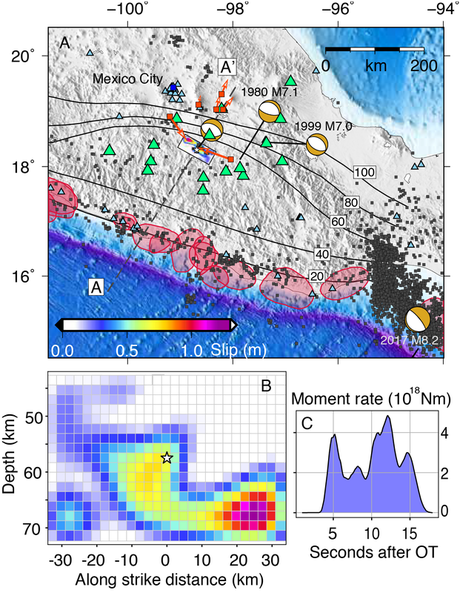
The Image to the right is from our study of the 2017 Puebla-Morelos earthquake which was very damaging for Mexico City. We found that the event occured at the edge of a "flat slab" as the subducted plate transitions from horizontal to a much steeper dip and plunges deep into the manlte. We found that at this bend in the slab large flexural or "bending" stresses are responsible for this event. We also found that the location of where the flat slab occurs might augur where other similar events in Mexico might yet occur. |
Tsunami propagation modelingThere is still much we don't understand about how the deformation of the ocean bottom produced by an earthquake couples into the tsunami initial condition. We are also still learning about how tsunami propagation interacts with the near-shore environment and produces hazardous inundation. We research all of these aspects with the ultimate goal of producing better, physics-based assessments of tsunami hazard worldwide.
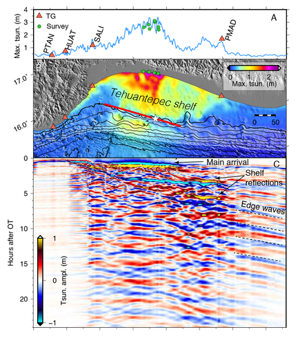
The image to he left is from our analysis of the tsunami produced by he magnitude 8.2 Tehuantepec earthquake. Remarkably we found that tsunami oscillations measured by tide gauges lasted as long as 3 days with hazardous waves for as long as 12 hours. Our analysis explained that this was because the very wide and flat Tehuantepec shelf very efficiently traps tsunami energy creating a resonance phenomenon that extends the duration of the sea-surface disturbances |
Earthquake and tsunami warningHow can we use what we learn about the physics of earthquakes and tsunamis to design automated systems that warn people in harm's way?
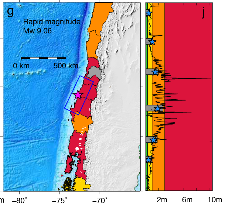
We are part of the US West-Coast wide ShakeAlert earthquake early warning project and we work on a variety of problems such as how to predict that an earthquake will keep growing and produce strong shaking. We also work on utilizing new machine learning techniques to speed up recognition that an event identifying the geographical extent of the rupture. We also work with NOAA's tsunami warning centers to introduce new methods and technologies into operations. We are helping them to develop new algorithms that use coastal GPS stations to help in forecasting the expected tsunami intensity int he first 2-3 minutes following the onset of a large earthquake. The image tot he right is a retrospective simulation of the magnitude 8.8 Maule earthquake. This is an example tsunami warning map produced in only 1 minute using information from coastal GPS stations. |
What will future earthquakes look like?In most places it can be many decades and even centuries before the next damaging earthquake happens, so how can we plan for something whose consequences might be unknown?
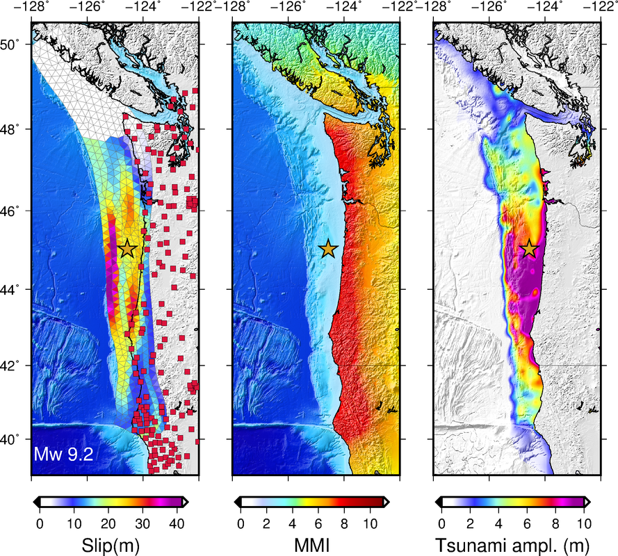
We work on physics-based methods to produce likely scenario events for these parts of the world where we know a large earthquake is only a matter fo time. We build numerical codes that simulate the rupture process of a large earthquake. Then we use these simulated ruptures to drive other simulations of the ensuing tsunamis and the strong shaking. We spend a lot fo time "validating" these scenarios to make sure that they reflect our best available knowledge of what is possible and physcially realistic. The image tot he left shows a magnitude 9.2 scenario event for the Cascadia subduction zone where no large earthquakes have occurred since the year 1700. For that simulation the image also shows the distribution of strong shaking and the likely tsunami amplitudes. |


